|
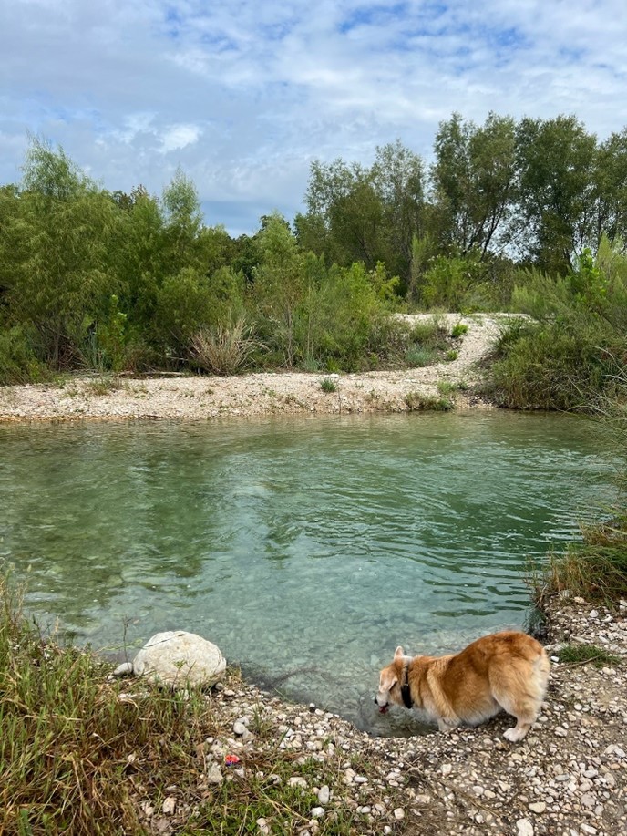
Happy fall, y’all! I just got back from a trip to the Nueces River (shown below with Gus the Corgi) to close out summer and welcome the new season. Fall is the beginning of the Texas Water Development Board (TWDB)’s new fiscal year and the start of our water level measurement season. This is a packed Gazette that includes an update on our Edwards-Trinity (Plateau) brackish aquifer study, a new segment with a featured hydrograph in the Edwards-Trinity (Plateau) Aquifer, and some news on upcoming changes to our Groundwater Data Viewer. I didn’t mention everything this edition has in store for you, so you’ll have to read on to find out!
Cheers,
Natalie Ballew, TWDB Groundwater Division Director
| |
By Heather Dodson
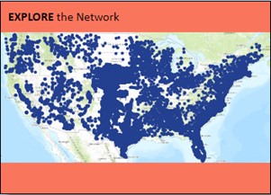
The U.S. Geological Survey (USGS) will be accepting proposals for its National Ground-Water Monitoring Network (NGWMN) funding program from October 10, 2024, through January 16, 2025. This initiative aims to enhance the collection and accessibility of groundwater data across the United States.
The funding supports:
- New and existing data providers in classifying monitoring sites
- Monitoring well maintenance
- Drilling new monitoring wells
- Purchasing continuous water-level data collection equipment
If you’re considering applying, we highly recommend contacting the TWDB at GroundwaterData@twdb.texas.gov or 512-475-3302 to help us coordinate data delivery to the USGS more effectively. We can also assist with the application process and may be able to provide a letter of support. Learn more about the NGWMN and funding program on the USGS website.
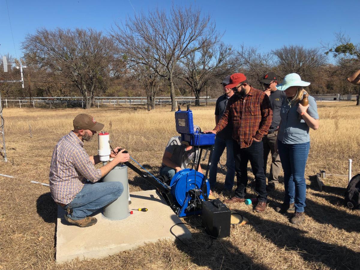
| | National Ground-Water Monitoring Network well locations in the United States (click the image for more information). | | Upper Trinity Groundwater Conservation District staff demonstrating their cool toys (equipment) to Groundwater Division staff in 2019. | |
’Tis the Season for TWDB Water Level Measurements
By Rebecca Storms and Colt Kernan
| |
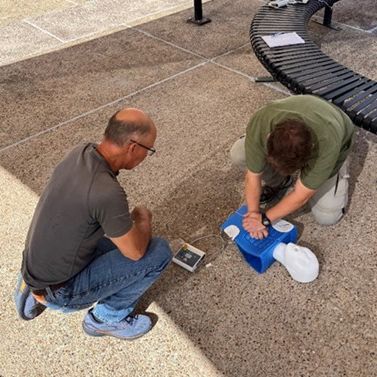
The new state fiscal year is here, and TWDB Groundwater Monitoring staff will begin annual groundwater level measurements in October. As always, monitoring will start in Central Texas and continue statewide through February 2025. We’re preparing for the season ahead, which includes safety and technical trainings like our Wilderness First Aid and CPR trainings pictured below.
We’ll be reaching out to groundwater conservation districts ahead of our planned trips. We love working with districts in our field work, and this is a great opportunity for us to connect and discuss collaboration and training opportunities.
When we plan for the water level season, we evaluate both TWDB and cooperator groundwater level monitoring activities in specific aquifers and counties to better target our resources in areas where increased monitoring may be needed. We’re always looking to expand our network and find new avenues for collaboration. Please contact us with any questions, concerns, or ideas as the water level monitoring season approaches.
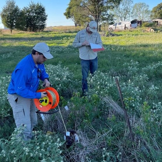
| | Andy Weinberg and Chris Goldmann testing their skills during Wilderness First Aid and CPR training held for field staff in August. | | Chris Goldmann measuring a water level using an electrical line while Chase Corrington takes field notes. | |
Update: Edwards-Trinity (Plateau) Brackish Aquifer Study
By Evan Strickland
| |
This year, the BRACS team finalized the stratigraphic surfaces for the Edwards and Trinity groups of the Edwards-Trinity (Plateau) Aquifer, covering the entire aquifer extent through the Plateau and Trans-Pecos regions and including a portion of the Maverick Basin. These surfaces are the most detailed of any study of this aquifer to date, including 4,142 well locations with stratigraphic interpretations for the Edwards and Trinity groups. The surfaces also adhere closely to outcrop data throughout the study area, including satellite imagery observations for precise outcrop elevation interpretations.
We’re continuing our work analyzing lithology, water quality, and aquifer properties using these surfaces and expect to complete the brackish aquifer characterization by the end of 2025. The stratigraphic surfaces and their underlying data are available online on the BRACS GIS webpage under BRACS study datasets, Edwards-Trinity (Plateau) Aquifer (in progress).
| | Hydrostratigraphic surfaces showing the top (left) and base (right) of the Edwards-Trinity (Plateau) Aquifer study area. The star symbol indicates the location of the featured hydrograph below. | |
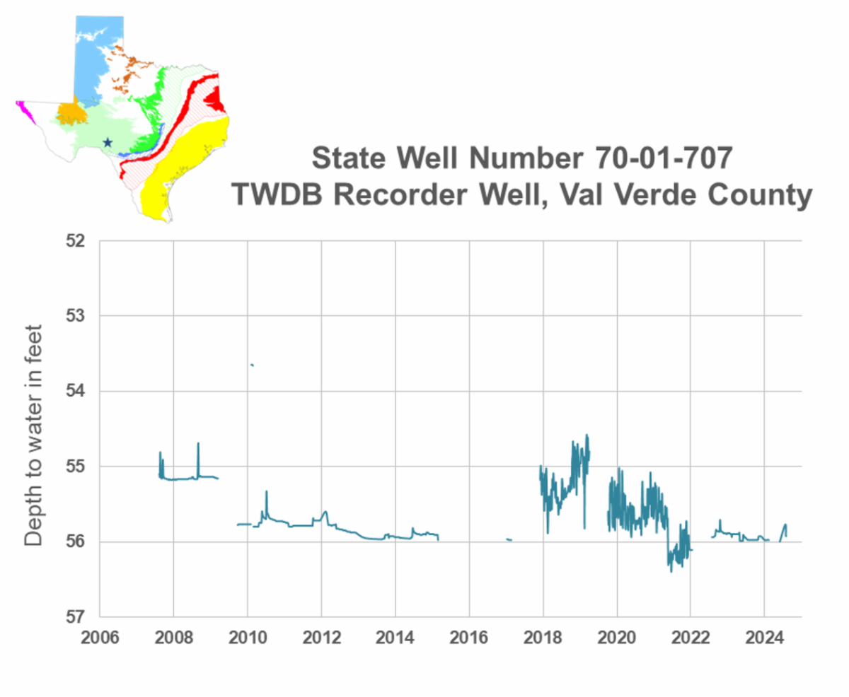
Featured Hydrograph: Edwards-Trinity (Plateau) Aquifer, Val Verde County
By Colt Kernan
| This issue’s featured hydrograph is from state well number 70-01-707 in Val Verde County. This well is drilled into the Edwards Limestone of the Edwards-Trinity (Plateau) Aquifer, and happens to be approximately 100 yards southwest of a cross-section line for the Edwards-Trinity (Plateau) brackish aquifer study mentioned previously. | | Hydrograph of state well number 70-01-707 showing water levels from 2006 through 2024. Data displayed is from the TWDB Groundwater Database. All data are provisional and subject to revision. | | The TWDB first measured this well via steel tape in March 2006, with a measurement of 52.17 feet below land surface. In August 2007, we installed an automatic water-level recorder that continues to collect hourly measurements. Over the entire period of record, water levels in this well only fluctuated by about four feet. The initial measurement taken in 2006 was the highest recorded water level in the period of record. In February 2010, water levels spiked abruptly, rising about two feet for the month before returning to previous levels. Prior to the data gap from about 2015 to 2017, water levels showed minimal fluctuation from year to year. Beginning in 2018, water levels fluctuate more regularly, potentially reflecting the effects of nearby pumping cycles or recharge events. Since then, water levels have declined but remained within the range of 54.58 feet in 2019 to 56.58 feet in 2022. | |
Upcoming Changes to the Groundwater Data Viewer
By Heather Dodson
The TWDB Groundwater Data Viewer is getting a facelift! The updates are designed to provide a more user-friendly experience with improved navigation and some new features that we hope will make exploring the map more enjoyable. We expect the new version to be released in January 2025.
What’s New?
We understand that changes to popular applications like the Groundwater Data Viewer can come with a learning curve. Our goal is to make this transition as smooth as possible. A draft Help Document is available for you to preview the expected changes. Additionally, we will be scheduling webinars alongside the release of the new viewer to help ease any frustrations that may arise.
| | Sneak peek of the new Groundwater Data Viewer home page | | Stay tuned for more updates and let us know if you have any questions, concerns, or suggestions to improve the new viewer by contacting GroundwaterData@twdb.texas.gov or 512-771-9038. | |
Accessibility Requirements for Local Governments
By Robert Bradley
On April 24, 2024, the Department of Justice published a final rule updating Title II of the Americans with Disabilities Act (ADA). This rule mandates that state and local governments ensure their web content and mobile applications are accessible to people with disabilities by April 26, 2027. The rule aims to eliminate barriers for people with disabilities, ensuring they have equal access to government services, programs, and activities online. This rule applies to all state and local governments, including groundwater conservation districts in Texas.
A compliance guide can be found on the ADA’s website. To prepare for this rule, local governments are encouraged to create policies, provide staff training, and establish processes to address accessibility issues.
| |
Regional Water Planning Group and Groundwater Management Area Representative Orientation
In July, staff from the TWDB’s Water Supply Planning and Groundwater divisions held an orientation meeting for the groundwater management area (GMA) representatives on regional water planning groups and planning group chairs. The meeting covered an overview of the groundwater management area and regional water planning process timelines, how information from each of the processes is considered, roles of representatives, and an update on planning activities. A recording of the meeting is available online and slides from the meeting are available on the TWDB website.
One item discussed at this meeting was the timing of state water plan information in desired future condition (DFC) considerations. GMAs are required to consider water supply needs and water management strategies in the 2022 State Water Plan when establishing DFCs. Your GMA may also want to consider water demand projections while establishing your DFCs. Typically, those would be projections from the current state water plan (2022 for this round), but the TWDB has new demand projections prepared for the 2026 regional water plans (RWPs). Additionally, draft 2026 regional water plan water management strategy data will be available in March 2025.
| |
Welcome New Staff
We are very happy to welcome Connie Beniquez, Yemara Tune, and Eva Dwelle to the Groundwater Division!
| | | | Connie Beniquez will be guiding all facets of contract administration for the Groundwater Division, including solicitations, contract development, risk assessments, payments, amendments, and closeouts. In her free time, she loves to try new cuisines and listen to all kinds of music. | | | | Yemara Tune is the newest Hydrologist on the Recorder Well Team in the Groundwater Monitoring Department. Yemara’s favorite part of the job is working outside as she enjoys the balance of office and field time. She also enjoys reading, exploring new hobbies and skills, and water activities like swimming, kayaking, or boat rides. | | | | Eva Dwelle joined the Groundwater Monitoring team as a Hydrologist on August 12. While completing her bachelor of science degree in Geography from the University of North Texas, she completed an internship with the Upper Trinity Groundwater Conservation District. She is originally from Austin and enjoys spending time outdoors, be it camping, hiking, kayaking, or even hammocking by a creek. | | Looking for water data? Check out available datasets in the Water Data Hub, including BRACS, springs, and recorder well datasets. | | Were you forwarded this email? Click here to join our mailing list. | | Leading the state's efforts in ensuring a secure water future for Texas. | | | | |